|
Advertisement / Annons: |
My walks in Stockholm:
|
Contents: |
Riddarholmen, Stockholm, 19th century and today (2019):The place I have chosen is the island Riddarholmen in Stockholm and the photographs are from the 19th century. Map over the places where the photographs are taken from:Now I just have to visit these places and take photos of how it looks today, easy or?
In some cases I have visited the place three times and taken new photographs until I'm satisfied. Still there are some problem, new buildings block my view and also need to do the perspective transformation better. 1a, Riddarholmen, at the end of 1860s:(Place the cursor over the image to see how it looks 2019)(it works better on my PC then on my smartphone, look at the new photo below) 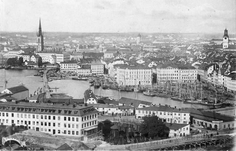
Kredit: Stockholm i slutet av 1860-talet.Digitalt museum More information: Bron över södra Riddarfjärden under byggnation, på sträckan Mälarstrannd-Riddarholmen. Fotograf/photographer: Okänd, unknown (cropped, resized, increased contrast, grey scale) This railway bridge during building shall connect the Northern railway with the Southern railway for the first time. It must have revolutionized the transportation a lot. Interesting to see is that the tower in the middle which is Santa Clara church is the old tower, replaced some year later with a new iron tower. First I thought that this photo must have been taken from the elevator Katarinahissen. But this photo is very old, it's 13 years before they built and opened the elevator 1883. This photo must have been taken from Mosebacke Theatre. Photo taken from 2019: 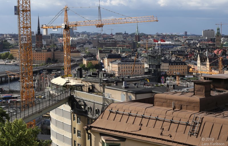
Now I have replaced the old photo that I used earlier. This photo is taken from Mosebacke Theatre. It doesn't fit correct, it must has been taken some 50 meters more to the left and a couple of meters higher. The terrace I stand on at Mosebacke theatre is something they built later, maybe in the 1940s. I used the 50 mm normal lens. 1b, Old Town and Riddarholmen, after 1883: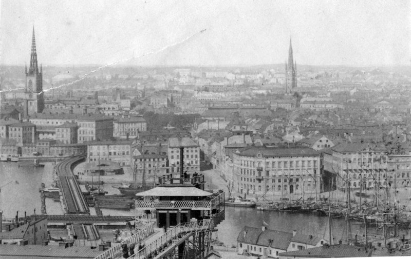
Kredit: Vy över Stockholm och gamla Stan.Digitalt museum More information: Vy över Stockholm och gamla Stan, sett från Mosbacke, Södermalm på 1870-talet. I förgrunden Katarinahissen. Fotograf/photographer: Okänd, unknown (cropped, resized, increased contrast, grey scale) Recently I found this photo, now the elevator Katarinahissen is built. The year must be wrong, they built and opened the elevator 1883. The elevator is powered by a steam machine. The photo is taken from Mosebacke Theatre. This elevator was replaced 1933 by the one we have today. More to read about Riddarholmen and the elevator at Wikipedia:
2, Riddarholmen, view from Mariaberget, 1880:(Place the cursor over the image to see how it looks 2019)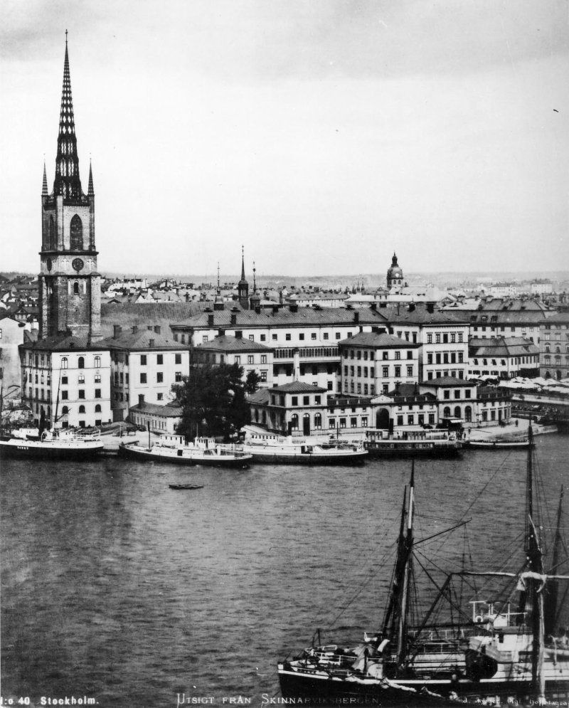 Kredit: From left: s/s Tjust byggd 1871Digitalt museum
More information about the ships, from left: s/s Tjust byggd 1871, s/s Nya Södertelge byggd 1868, s/s Hållsviken II byggd 1870, s/s Sjöfröken byggd 1880 samt obekant ångslup. Närmast syns lastångaren Betty. Hållsviken II såldes i dec 1888 så bilden kan inte fångats senare än det årtalet. Fotograf/photographer: Jaeger, Johannes (cropped, resized, increased contrast, grey scale) The church Riddarholmskyrkan dominate the island Riddarholmen, our old kings are buried here. Before the church it was at this place a monastery, the Grey Friar's Abbey, Stockholm. You can find parts of the monastery in the basement of the parliament house, the big building to the right. I couldn't get the perspective correct from Skinnarviksberget as the old photo is told to be taken from, I had to move to Monteliusvägen, a couple of hundreds meter to the East, to get it correct.
Photo from 2019. 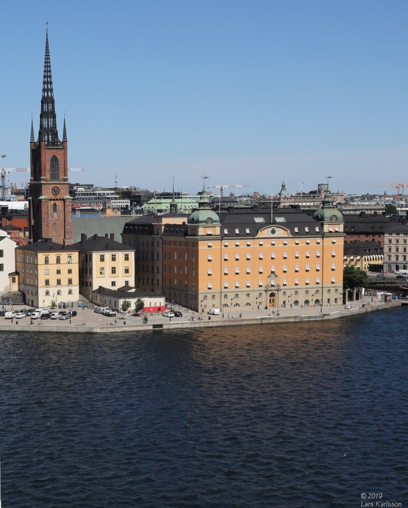
Photo from 2019 with high resolution, opens in a new window. When comparing the old and new photo one very obvious thing is the parliament house has a new facade to the South. More to read at Wikipedia:
3, Riddarholmen, view from Slussen, 1870s:(Place the cursor over the image to see how it looks 2019)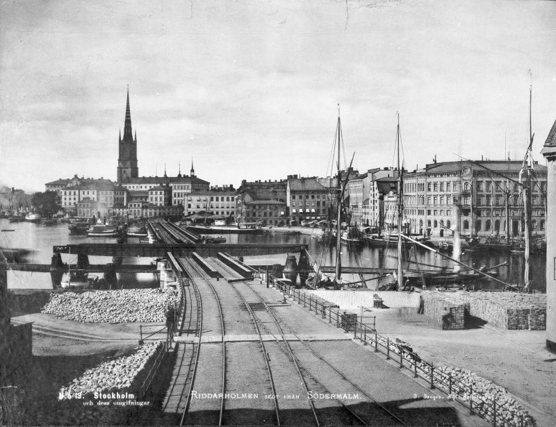
Kredit: Riddarholmen från söder, SammanbindningsbananDigitalt museum Fotograf/photographer: Okänd, unknown (cropped, resized, increased contrast, grey scale) This early railway bridge was possible to open to let the boats pass through, the new bridge which is higher can not. A walking path cross the railway, with todays high intens railway traffic it's not possible. This bridge was built 1871. Zoom in the picture at its original source and find a lot of details, use the link above. Photography from 2019. 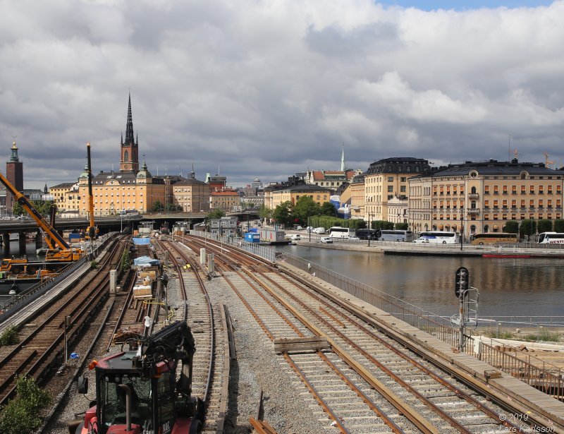
I found that I can use the bridge / street just above the railway and find the correct position from old maps. Todays railway is about 6 meters above the ground level and the old railway was placed direct on the ground which gives another perspective. Also the bridge I standing on are higher and that give wrong perspective as you see on the lower harbor line. The old photograph is taken with a normal lens. I used a 50 mm lens on fullframe. More to read about Sammanbindningsbanan (railway connection) at Wikipedia:
4, Sammanbindningsbanan at Kött-torget, 1870s:(Place the cursor over the image to see how it looks 2019)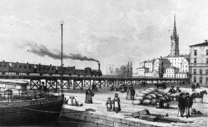
Kredit: Sammanbindningsbanan vid Kött-torget.Digitalt museum More information: Bron över Norrström, Riddarholman. Södra delen av Riddarholmen. Fotograf/photographer: Okänd, unknown (cropped, resized, increased contrast, grey scale) In front of us Gamla Stan (Old town) and in the background the island Riddarholmen. The square is the Kött-torget (Meat square), closed soon after the railway was build. A new market opened 1884 at Hötorget and replaced this market. Photography from 2019. 
The view is blocked by workers' house, I have to come back later when the houses are gone. This original is a drawing, I see that I must go a couples of meters to the left to get correct perspective. The painter must have been sitting on a boat above the ground, because you see the people from above. This photo is taken with a 35 mm lens. More to read about Stockholms saluhallar at Wikipedia:
|
|
Advertisement / Annons: |
5, Railway bridge crossing Riddarholmen's canal, 1890:(Place the cursor over the image to see how it looks 2019)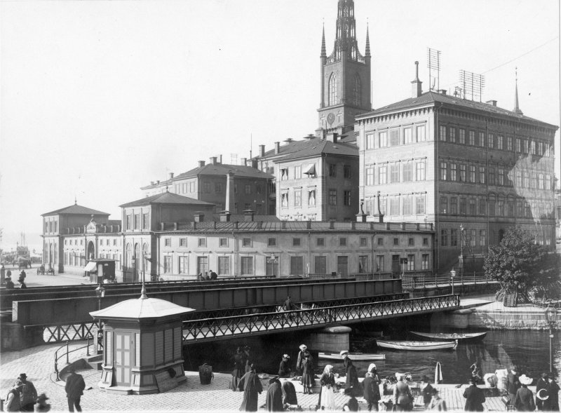
Kredit: Järnvägsbron över Riddarholmskanalen.Digitalt museum Fotograf/photographer: Okänd, unknown (cropped, resized, increased contrast, grey scale) In old days the islands Riddarholmen and Gamla Stan was separated by a canal, in this photo the canal is still open. But if you visit Riddarholmen on the other side of the bridge you can still see where the opening to the canal was. The big building is the "new", today old Parliament house, they moved in here 1866 but the building is much older. They stay here until the new Parliament house at Helgeandsholmen was built 1905. Photography from 2019. 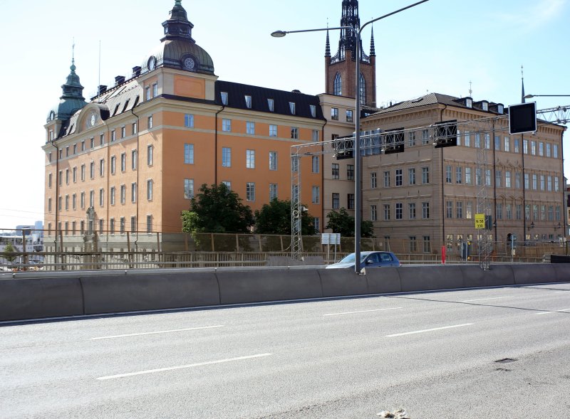
Even this view has been ruined, our city is not as beautiful as it was once. Photo taken from Centralbron because I see that the photographer must have been on the first or second floor. The house he stood in was cut in half to give space to the railway. Photo taken with a 35 mm and then cropped down to about 45 mm. More to read at Wikipedia:
6, Geijersk's house or Creutziska's house, 1865:(Place the cursor over the image to see how it looks 2019)
Kredit: Geijerska huset eller Creutziska huset.Digitalt museum More information: Geijerska huset eller Creutziska huset, som det också kallades låg på Riddarholmen 1865, avtecknad av J. F. Meyer s:or. Litografi i Illustrerad Tidning nummer 45 den 11 November 1865. Fotograf/photographer: Okänd, unknown (cropped, resized, increased contrast, grey scale) This house, Geijerska house was demolished when the railway was built in the 1870s. The house behind and to the left is the house Hebbeska. Only the building behind is left and built together with the Parliament house. To the right you see the Riddarholmen's Church. 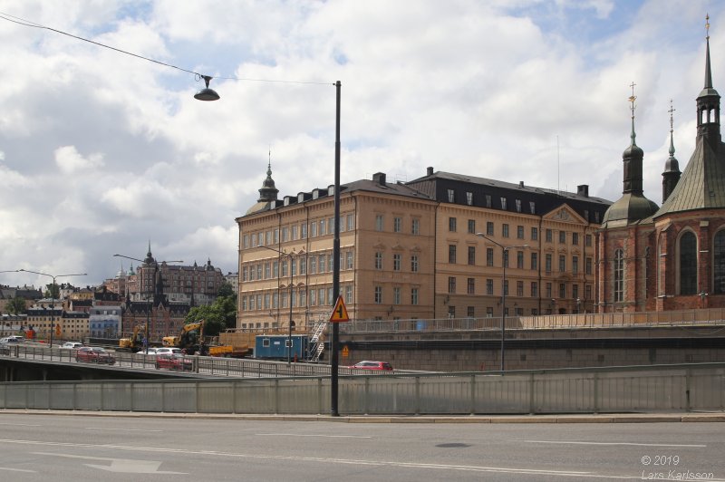
It looks as if they had added one extra floor on the Hebbeska house. The perspective of the drawing is a bit strange. Photo taken with a 35 mm wide angle lens and then cropped to fit. More to read:
7, Riksdagen's new house, 1871:15 years later relative the photo above it looks like this. (Place the cursor over the image to see how it looks 2019)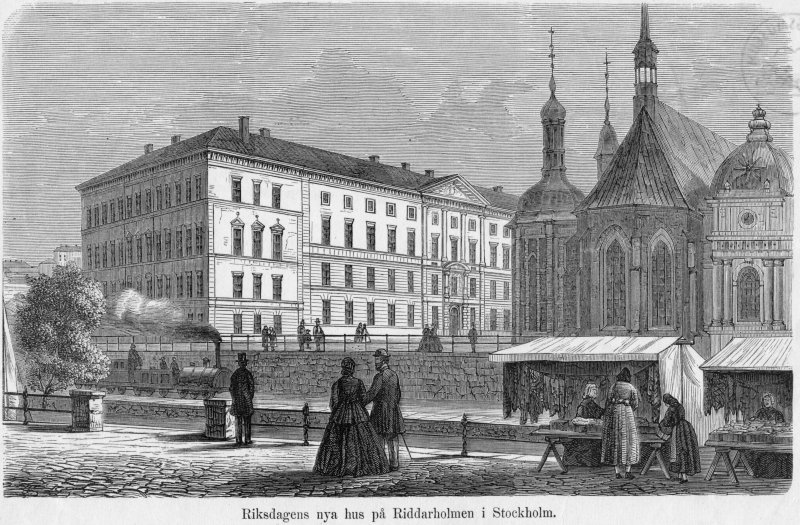
Kredit: Riksdagens nya hus på Riddarholmen Stockholm.Digitalt museum More information: Riksdagshuset togs i bruk 1829 av präster-borgare och bondeståndet. 1865 inflyttade även adelsmännen dit. Fotograf/photographer: Okänd, unknown (cropped, resized, increased contrast, grey scale) Photography from 2019. 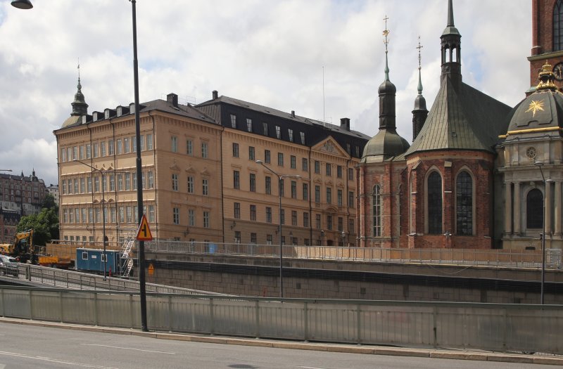
The Parliament building is now finished. Not much difference look at Riddarholmen compare to today. But between we now have subway, railways and the big road, Centralbron. I wish they would dig down the railway and roads in a tunnel, I want the nice town back! It's difficult to fit a photo to drawing, it depends much about how the painter used the perspective. You can compare the drawing as a photo taken by a 50 mm normal lens. More to read about Gamla riksdagshuset at Wikipedia:
8, Riddarholmen's harbor, Southwest, 1890:(Place the cursor over the image to see how it looks 2019)
Kredit: Fo28699ADigitalt museum Comments about the boats, from left: Arboga No 1, Örebro I, Eskilstuna, Visingsö, Primus, Fyris I, Upsala, Nya Upsala and one more Göta kanalångare. Fotograf/photographer: Okänd, unknown (cropped, resized, increased contrast, grey scale) The steam boat traffic was extensive at the end of the 19th century. The farmers came in to Stockholm city to sell their crops, meat and fish. Photography from 2019. 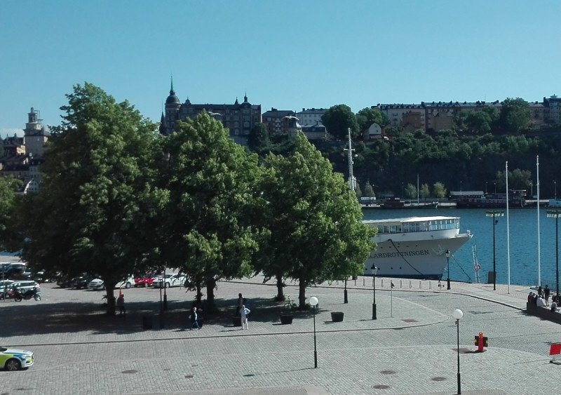
No boats anchor at this harbor anymore. When I was young I followed my parents to this place to celebrate midsummer. The square has now the name Evert Taube's terrace after our famous poet and singer. My father like Evert Taube a lot, partly because he was a sailor too in young age. Then they both also had the same name, Evert. It looks to be have taken with a short telephoto lens, but more likely they cropped the original photo. I have to come back in the winter when there are no leafs on trees. More to read about Evert Taube's terrace at Wikipedia:
9, Riddarholmen, harbor and railway, 1870s:(Place the cursor over the image to see how it looks 2019)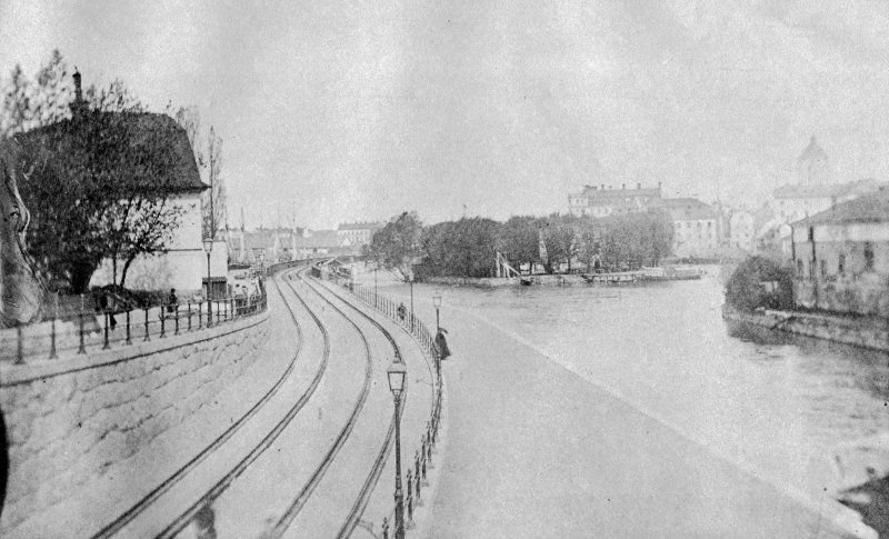
Kredit: Kajen vid Riddarholms kanalen.Digitalt museum Fotograf/photographer: Okänd, unknown (cropped, resized, increased contrast, grey scale) In the middle is the small island Strömsborg. Once a dancing palace, Adam and Marie, and even earlier a bath. To the right is one of the wings of the Riddarhuspalatset, Knight house palace. Photography from 2019. 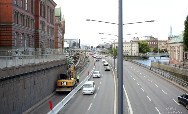
They have moved the railway to a tunnel to the left. The old railway was placed where the two left traffic lanes are today. The only reference point I had between the two images is the island Strömsborg, everything else is changed. The old photography looks to have been taken with a normal lens. More to read at Wikipedia:
10, Riddarholmen, railway, view to North, 1896:(Place the cursor over the image to see how it looks 2019)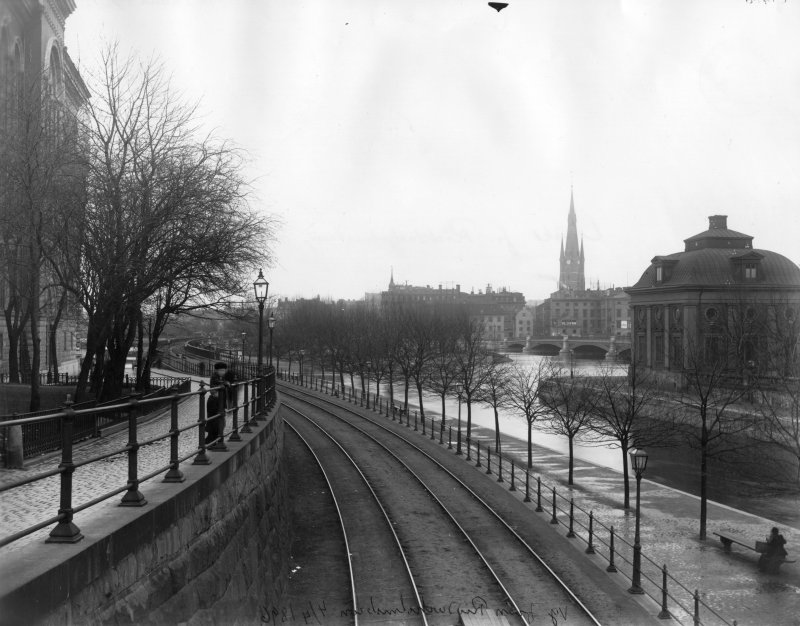
Kredit: Utsikt från Riddarholmen norr ut.Digitalt museum Fotograf/photographer: Stockholms Stadsmuseum (cropped, resized, increased contrast, grey scale) 25 years later, they have now built new wings to the Knight house palace at right. In the background you see Santa Clara church's new iron tower. Photography from 2019. 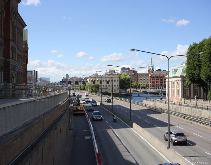
A sad view to see all this traffic of trains and vehicles. They have made it extra difficult to me and placed two big road signs in front of me where I have to take the photo from. I could only take photos from between them or to the right side of the road signs. I also need a wide angle lens, maybe a 40 mm lens will fit. This is my third attempt to get a photo from the correct direction, still not perfect because of the road signs. The space between them isn't wide enough to move the camera to the left which I need to get it perfect, maybe a half meter. The lens I used is an old 35 mm Vivitar on full frame camera and after the photography is cropped. More to read about Riddarhuspalatset at Wikipedia:
11, Old bridge between Riddarholmen and Gamla Stan, 1870s:(Place the cursor over the image to see how it looks 2019)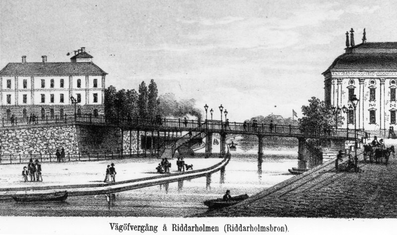
Kredit: Vägövergång vid Riddarholmen.Digitalt museum Fotograf/photographer: Okänd, unknown (cropped, resized, increased contrast, grey scale) They had to take down the old stone bridge when they built the railway and replaced it with this iron bridge. Part of the stone bridge is preserved at Stockholm's City hall, see the link below. I have seen that stone arc before but didn't know it was a part of this bridge. Photo from 2019. 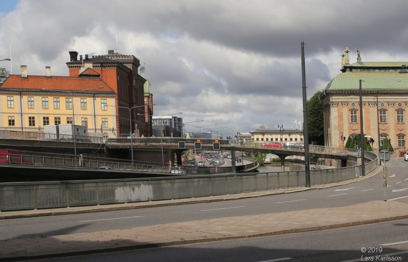
Cropped and perspective corrected to fit the old photo. The drawing looks to fit with a normal lens, I took the photo in front of Gåsgränd 11. To have it more correct I have to take it from first or second floor. The canal was much wider in earlier days and it was a lot of boat traffic here. The earlier iron bridge is gone and replaced by a concrete bridge. Does it looks nice? No! More to read about Riddarholmsbron at Wikipedia:
12, Riddarholmen, view from Rödbodstorget, 1875:(Place the cursor over the image to see how it looks 2019)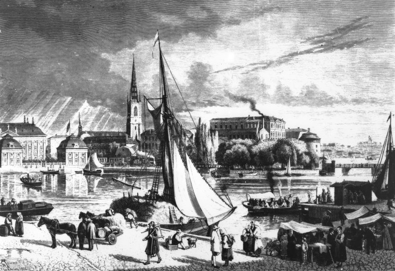
Kredit: Utsikt från Rödbodtorget, över Riddarholmen - StrömsborgDigitalt museum Fotograf/photographer: Okänd, unknown (cropped, resized, increased contrast, grey scale) In earlier days when there were no bridges the sailing ship anchor with farmers that visited to sell their gods. The tower to the right, Birger Jarls torn is one of the oldest buildings we have left in Stockholm, built about 1527. Photo from 2019. 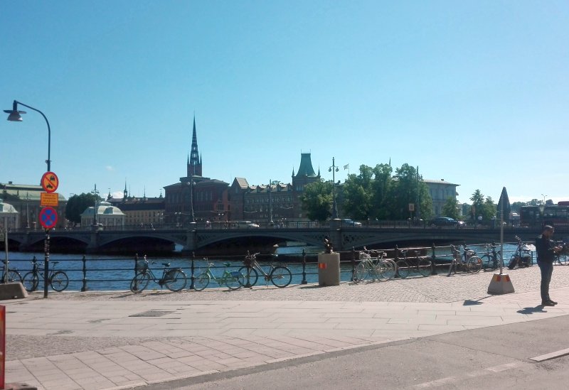
The drawing looks to fit with a 35 mm lens (full frame), but the perspective is wrong, I have to move back and to the left to get it correct. But the artist seems to have excessive the height of the church tower. After I have examine the new photos I see that the painter must have stood on the terrace of Sparreska palace (Fredsgatan 12). They are doing some building work at the palace now, I have to come back later when they are finished. More to read at Wikipedia:
|
| Go Back |