|
Advertisement / Annons: |
My travels in Sweden:
|
Contents:
|
|
You can use the maps from Stockholmskällan. It has the function that you can compare maps from different years. It's only one map that cover the areas outside Stockholm City, the map from 1934. |
|
I was alone and took my car for a drive, didn't know where to go. Then I remember from our last walk from Liljeholmen there was a part that we missed, Gröndal. I headed to Gröndal for a look. I didn't have my camera with me, only mobile phone. I have added links with deeper information, most of them are Wikipedia links. I have chosen the Swedish link, but in some cases you can shift to English. If there is no English version you can use Google translator or similar service. There are more information in the Swedish language. Harbors in Gröndal:Map over my walk:Walk in Gröndal, it's about a 6 km long walk. Western main road to Stockholm, Liljeholmen:I start at Lijeholmen and walk towards Gröndal. 
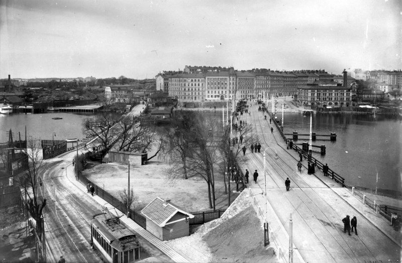
First I want to convince me where the old main road to Stockholm connected to the wooden bridge. Here is the road coming down from Liljeholmen. On old maps I have seen it goes direct to the bridge. 
In front of us a concrete pier, I think that one is of later date. But Gunilla told me when she saw this photo, "look, there are marks on the street that symbolize the old road!" . Imaging standing here at the 1920s and have the tram, people cycling and walking to their jobs.  Kredit: Gamla och nya bron. Järnvägsmuseet Fotograf: Okänd (slightly cropped and resized) It's the bridge to the right, the bridge to the left is even older. There are more links with information about the bridges in Liljeholmen in my earlier story about Liljeholmen. Gröndal:
I walked Eastwards and follow the railway tracks, I have now come to Gröndal, just a few hundred meters walk. Once it was a car manufactory here, AB Gustaf Ericssons Automobilfabrik. More to read about AB Gustaf Ericssons Automobilfabrik at Wikipedia:
Gustaf was a son to the more famous Lars Magnus Ericsson, the man with the telephones. On the map from 1934 there is a sign that at this place it was a shoe factory, maybe they took over the automobil factory. Here is a movie, The giant fire at Liljeholmen:
It's not of todays HDTV quality, but at the end you can see what's left of the factories. 
The railway ends at the concrete factory Cementa. It could be here the shipyard Löfholmsvarvet was placed long time ago. More to read about Löfholmsvarvet:

My memories from 1960s are that it look like this even at that time. More to read about Cementa at Wikipedia:
Remiersholme (on other side):
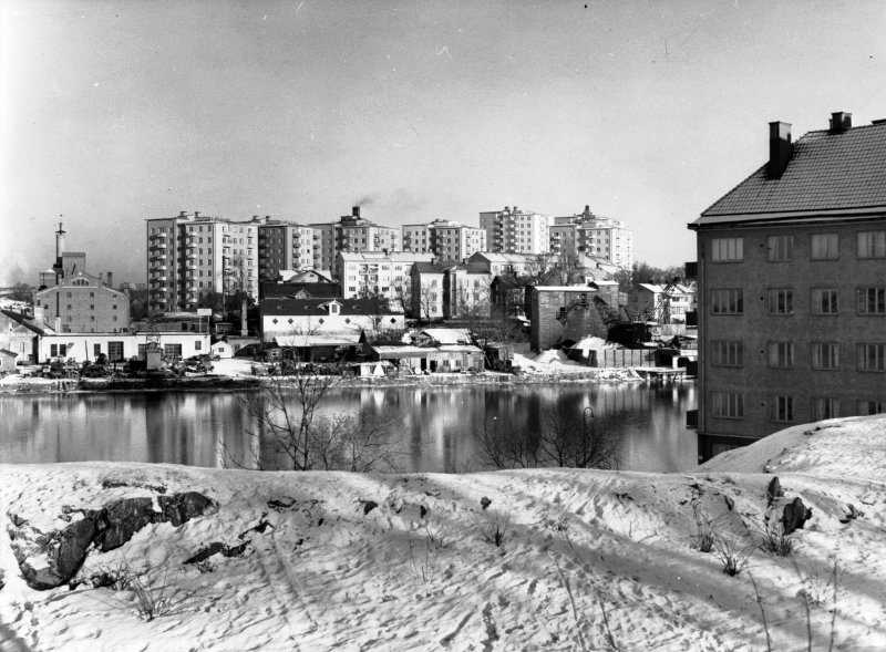
On the other side we see the island Reimersholme. The houses we see here was built in the 1980s and earlier was here a liquor factory, Reymersholms Spritförädling AB. In that time it was outside Stockholm City and then it was legal, the boat traffic from Stockholm City to here was intense.  Kredit: Byggherre: Byggnadsaktiebolaget Contractor, Stockholm. Vy över 1200 lägenheter som Contractor byggde för HSB. Arkitekt SAR Sven Wallander. Tekniska Museet Fotograf: Okänd (resized) This is an early photo from when they built the HSB houses at Reimersholme in 1981, you can still see parts of the liquor factory. More to read about Riemersholme at Wikipeia:
De Förenade Kolsyrefabrikernas AB, Gröndal:
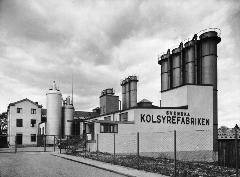
This carbon dioxide factory was active from 1896 to 1988. It's placed at Lövholmen in Gröndal. In the 1950s they could produce three tons of gas per hour, one of the biggest factories in Europe at that time. 
It hasn't changed much since the 1960s that I have memories from. Compare with the photo from 1943 below.  Kredit: Svenska Kolsyrefabrikens anläggning vid Gröndal. Tekniska Museet Fotograf: Okänd (resized) More to read about De Förenade Kolsyrefabrikernas AB at Wikipeia:

|
|
Advertisement / Annons: |
Beckers färgfabrik, Lövholmen:
East of the carbon dioxide factory you find Becker paint factory. More to read about Beckers färgfabrik:
Gröndals boat club:
Opposite to the factories we have the boat club Gröndal. Could the red store house be something left from Lövholmens Varf? 
Gröndal's boat club house. Reimersholme in the background. 
The factories in the background. I think the shipyard Lövholmens varf was placed where the factories is today, all the way from Cementa. 
On the other side, Reimersholme. You see the white triangle in the middle? That's a part left from the liquor factory, a store tank they have cut apart. 
By luck the sand ship Jehander passed by. They have transported sand to Stockholm as long as I can remember. More to read about Jehander at Wikipedia:

I didn't know we had a street with the name Lusuddsvägen in Stockholm. |
Street Gröndalshamnen:

Reimersholme on the other side. 

I don't think there have been any industry or factory along this street. Street Ormbergsvägen:
I have seen the prices for these flats, nothing for a normal worker! 
Old comune office rebuilt to apartments. 
It is the island of Reimersholme in the middle. 
Nowadays there are nice walking bridges here. |
Street Sjöbjörnsvägen:
In the background the island Stora Essingen and the bridge is Essingeleden. 
Background to the right, Marieberg. 
The houses in old Gröndal are very different designed. Street Utsiktsbacken:
Street Gröndalsvägen:
Now I have came to the end of Gröndal. Once there was a big shipyard here, Ekensberg, even I have memories from it. When we passing by with our boat there were always a lot of ships anchored here. The ferries that go to the island Gotland were common to see here for maintenance. 

The shipyards main building was to the left, nothing left of this big shipyard. 
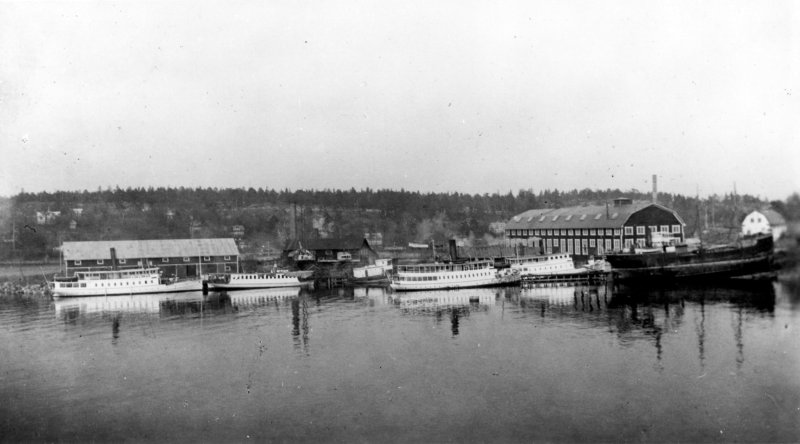
Eastern side of the land where the shipyard Ekensberg was placed.  Kredit: Ekensbergs varv, Stockholm. Sjöhistoriska Museet Fotograf: Okänd (resized) More to read about Ekensbergs Varv at Wikipedia:
|
Mörtviken:
The shipyard had a lot of ships anchored in this bay, nowadays only private pleasure boats.
|
| Go Back |